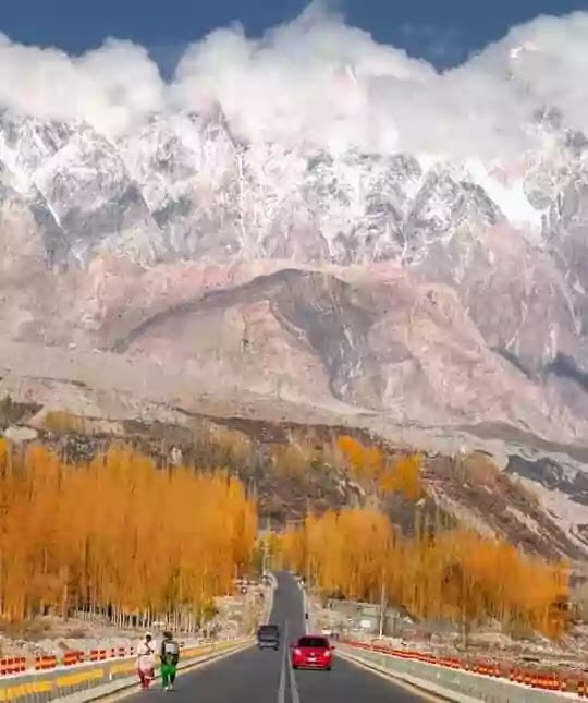
It's everything here about Gilgit Baltistan province of Pakistan, likewise culture, traditions, language, religion & sects, area, location, population, and reasons that made it a most favorite place of travelers.
Gilgit Baltistan Province
Here are some facts and reasons that why you must plan a tour to travel to Gilgit Baltistan and explore it as there are several things serving GB to become more famous and attractive among tourists.
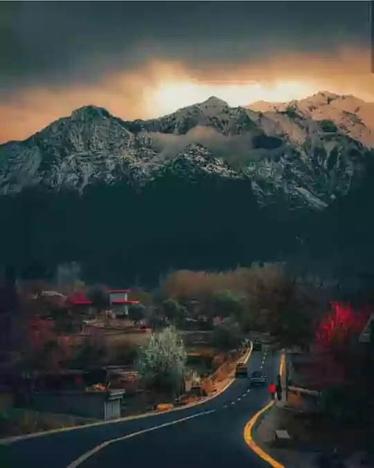
Beautiful valleys, waterfalls, lakes, high mountains, historical places, and serene landscapes enchant the hearts and minds of those who see them. Which can only be found in pieces of heaven.
In today's blog, I will provide you with useful information about tourism in Gilgit Baltistan, beautiful waterfalls, valleys of Gilgit, and the world's highest mountains in the region which will add to your interest and information.
Gilgit-Baltistan is a beautiful land in the north of Pakistan. It is the good fortune of Pakistanis to have this piece of paradise in Pakistan. And very unfortunate are the people who did not get to see these valleys.
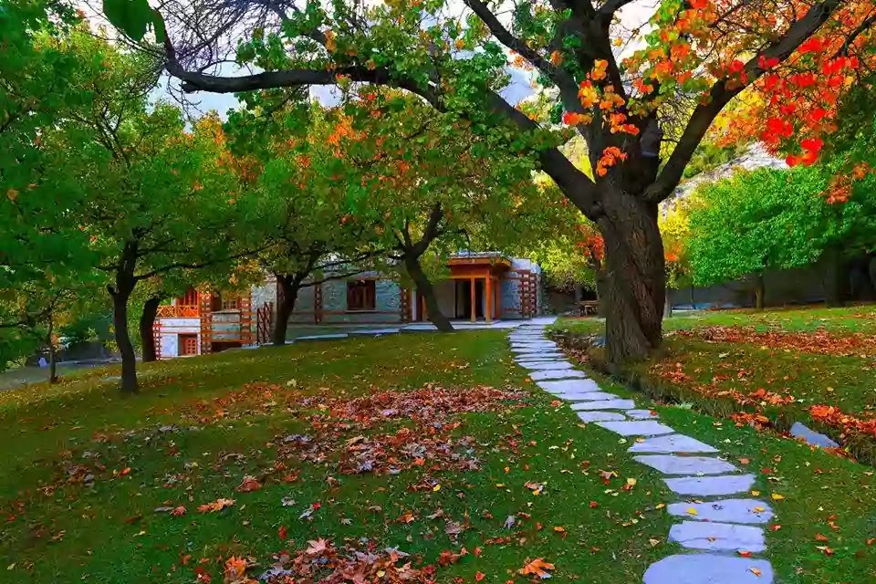
And even more miserable are those who leave Paradise and go to Europe and other countries for leisure and vacations. God Almighty has blessed this Piece of land with such invaluable things which you will not find in the whole world.
Facts and Figures
There are many facts which are making figures to improve tourism in Gilgit Baltistan, Pakistan some of these are.
- Area and Population
- Ordinance to Rename
- Location
- Tourists Places and Administration
- Peaks and Mountain Ranges
- Personalities
- Glaciers
- Lakes
- Meadows and Deserts
- Karakoram / Silk Road
- Accessibility
- Scenic Views
- Whether or Climate
- Ethnic and Sects
- Language and Communication
- Religion
- Cultural and Tradition
- Economical Activities
- People of Gilgit Baltistan
- Sports and Activities
- Indus River
- Veggie, and Fruits
- Beautiful Landmarks
Area and Population
Gilgit-Baltistan has a total area of 72,971 km and a population of about 2 million. Gilgit-Baltistan is a limited autonomous region with Gilgit as its capital. The old name of Gilgit-Baltistan was Northern Areas.
Ordinance to Rename
In 2009, President of Pakistan Asif Ali Zardari passed an ordinance to change the name from Northern Areas to Gilgit-Baltistan.
Location
If I could tell you about its location and surroundings, to its east and northeast is the Indian-occupied valley on the border of Jammu and Kashmir, Khyber Pakhtunkhwa to the west, Afghanistan's Wakhan Corridor, and China's most Muslim populous province, Xinjiang, to the north. It is bordered by Azad Kashmir to the south and Ladakh to the southeast.
Tourists Places and Administration
Gilgit-Baltistan consists of beautiful valleys like Skardu, Rondo, Shiggar, Tharmang, Galtri, and Khaplu. Administratively, Gilgit-Baltistan is divided into three divisions and six districts.
This region has always been a tourist attraction due to its beautiful scenery, beautiful valleys, high and lofty mountains, and different races and their different customs.
Peaks and Mountain Ranges
Gilgit-Baltistan has the second-highest peak in the world after Mount Everest. Nanga Parbat, popularly known as Killer-Mount, also stands tall on the land of Gilgit-Baltistan. It is one of the most difficult mountains in the world like Passu Cones of Hunza Valley.
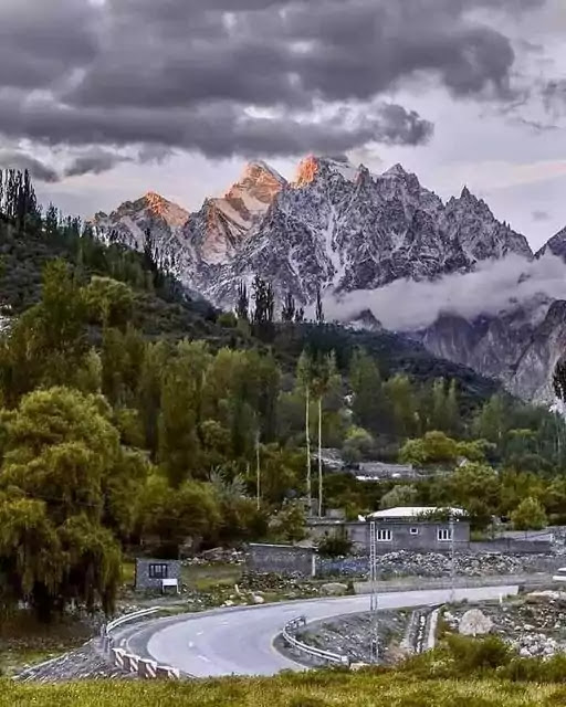
Gilgit-Baltistan has about 50 peaks that are more than 23,000 feet high. The region is located in the center of the world's highest mountain ranges. It contains the Karakoram Mountains, the western Himalayas, and the vast mountain ranges.
Personalities
Samina Baig from Hunza Valley is the first Pakistani woman and the third Pakistani to climb Mount Everest. At the age of 21, she is the youngest Muslim woman to climb Everest. And Hassan Para from Skardu Valley is a Pakistani woman who managed to climb not only the world's highest peak, Mount Everest but also K1, K2, and Nanga Parbat.
Glaciers in Gilgit Baltistan
Excluding the polar regions, the three longest glaciers in the world are also found in Gilgit-Baltistan. Which includes the Baifa glacier, Baltor glacier, and Batore glacier. The presence of mighty glaciers in Gilgit Baltistan is a huge reason that made it very famous.
Lakes in Gilgit Baltistan
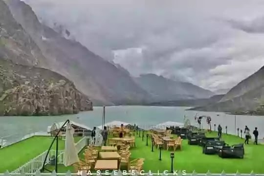
And besides, there are lakes located at the highest point in the world which includes Attabad Lake, Soshar Lake, Naltar lake Located in Naltar valley, Sadpara Tosso lake located in Skardu, Foroogh Toso lake, Kharagh Lake, Rama Lake Near Astore, and Gharmaes Lake located in Gharmang are very beautiful and famous lakes in the world.
Meadows and Deserts
Deosai is the second highest national park in the world after Tibet, which was given the status of a national park in 1993. The field covers an area of 5,000 square kilometers, south of Skardu and west of Ladakh.
The area is covered with snow for nine months and is cut off from Astor and other parts of Gilgit-Baltistan, especially in winter.
Karakoram Highway / Silk Road
The world's highest road, the Karakoram Highway, also passes through this area, which is 15,397 feet above sea level.
It runs from China City Kashgar to the Pakistani city of Hassan Abdal. Landslide is normal here travelers on this road know it very well.
Accessibility
It is a 20 to 24hours drive from Islamabad-Rawalpindi to Gilgit-Baltistan. One Fokker F-27 was operated daily between Benazir International Airport and Gilgit Airport by Pakistan International Airlines.
Scenic Views
It was one of the most beautiful flights in the world. It flew over Nanga Parbat. It was about 50 minutes flight. But after the crash in Multan in 2006, the F-27 plans were grounded and ATR-42 plans were made operational on this route.
Pakistan International Airlines also have a flight schedule of Boing-737 from Islamabad to Skardu. There would be a flight delay in winter due to fog or bad weather.
Whether or Climate
The climate of Gilgit-Baltistan varies from region to region. Due to mountain ranges in the region, climate change happens in different areas. The Karakoram and the Hindu Kush ranges are quite dry, while in valleys like Chilas, Astore, Thaplu, Hunza, and Niggar, the weather is quite cold even during summer. And the temperature here is even lower than the nearing cities it keeps about 17 to 25 degrees celsius.
Ethnic and Sects
Most of the population of Gilgit-Baltistan is divided on the basis of national ethnic and religious sects. Its major and well-known ethnic groups include the Balti, Shamzi, Kashmiri, Lashkar, Pathan, and the Kohistani.
A large number of people from Gilgit-Baltistan live in different parts of Pakistan. Karachi in particular has a large population of people from Gilgit.
Language and Communication
Urdu has the status of being the national and official language of Gilgit-Baltistan, so many different languages are spoken in it.
English language in school and the Arabic language in Mosques are used for educational purposes in this region. Balti, Shina, and Baroshki are the most widely spoken languages in the region.
Religion
More than 99 percent of Gilgit-Baltistan's population is Muslim, with the majority being Shia Muslims. In Skardu, about all are Shia Muslims there. However, in Diamir and Astore there are Sunni Muslims are in the majority population.
Cultural and Tradition
The culture includes a mix of different races. The major cultural events of this land include the Shandur polo festival, the Babusar festival, the Spring Festival, and the Old Man Dance. It is a traditional dance in which some people dance in old-style clothes.
Economical Activities
Economically this region is mainly based on the traditional and historical route, the Silk Road. In addition, the China Trade Organization form informed the locals about investment and modern trade.
The rest is related to agriculture and the tourism sector. The agricultural products include wheat, corn, barley, and fruit, while trekking and mountaineering are the most popular in the tourism sector.
People of Gilgit Baltistan
The people of Gilgit-Baltistan are economically stable, morally very sociable, and loving. Special attention is paid to education here. 99% of the population of Gilgit-Baltistan is literate and highly educated.
Sports and Activities
There are so many sports here but Polo is widely played, and a famous sport here. About every valley has a Polo ground in Gilgit-Baltistan. Polo matches played on these grounds attract not only locals but also foreign tourists.
Shandor festival holds a Polo tournament every year in which Gilgit and Citral Polo teams participate. Other popular sports include football, cricket, volleyball, and more.
Indus River
Indus river is the largest river in Pakistan which irrigates a wide part of the country besides Punjab. It begins at Lake Mansoro in Tibet. The river descends from the mountains into Khyber Pakhtunkhwa and enters the plains. Passing through Punjab and Sindh, it joins the Arabian Sea near Karachi.
Veggie, and Fruits
Surrounding the Indus river and the high mountains, Skardu's red apple, apricot, and cherry orchards are enough to beautify the valley.
Beautiful Landmarks
The famous and heartwarming places of Gilgit-Baltistan are Hunza Valley, Hoshi Valley, Naltar Valley, Khunjerab Pass, Deosai National Park, Fairy Meadows, and K-2 basecamp.
